Evacuation Route Vegetation Clearance Grant
Kent Woodlands Evacuation Route Clearance Begins September 2019
Kentfield Fire Protection District has identified high hazard areas in the Kent Woodlands where improvements can be made to reduce the amount of hazardous vegetation located along PRIMARY and SECONDARY EVACUATION ROUTES. Many properties located on and around the Kent Woodlands were found to be non-compliant with fire code requirements for roadside vegetation clearance.
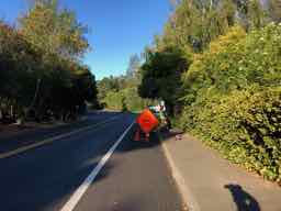
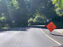
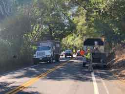
Kentfield Fire Protection District has partnered with FIRESafe MARIN and CAL FIRE to provide funding for the initial clearing of vegetation located along 8.73 miles of roadways, with a project budget of $130,991. Funding for this project is provided through a cooperative Fire Prevention Grant by CAL FIRE and California's Greenhouse Gas Reduction Fund. During the months of September and October, 2019, for a period of 4-6 weeks, personnel from the Fire District and FIRESafe MARIN will be working with private contractors to begin the clearing of vegetation along the roadways. Read below to learn more about this important program:
- Letter to Residents
- Fire Code
- Example Images
- Privacy Screening
- Work Calendar
- Contractors
- Project Map
Letter to Residents of Kent Woodlands: August 2019
Download the full letter in PDF format
August 2, 2019
Dear Property Owner,
Since 2015, California and the North Bay have experienced a dramatic increase in the number, frequency and intensity of catastrophic wildfires. Marin has a long history of devastating wildfires, including many in Kentfield and nearby communities.
The California Fire Code, International Wildland Urban Interface Code and Public Resources Code require that any person who owns, controls, or leases property located within a designated Wildland Urban Interface “WUI” Zone maintain 100-150 feet defensible space around structures, 14 feet of vertical clearance over roadways, and 10 feet of horizontal clearance along roadsides and driveways.
The Kentfield Fire Protection District has identified high hazard areas in Kentfield where improvements can be made to reduce the amount of hazardous vegetation located along primary and secondary evacuation routes. Many properties located within the Kent Woodlands have been found to be non-compliant and do not meet roadside vegetation clearance standards.
The Kentfield Fire Protection District has received a grant through CAL FIRE and FIRESafe MARIN to provide funding for the initial clearing of vegetation located along the roadway properties throughout the Kent Woodlands. In the months of September and October personnel from the Fire Department will be working with private contractors to begin clearing vegetation along the roadways. The work will include the following:
- Cut back or remove vegetation and tree limbs that encroach into the roadway.
- Remove low hanging tree limbs that extend over the roadway to create at least 14-16 feet of vertical clearance.
- Remove hazardous or combustible vegetation located within 10 feet (horizontally) of a roadway. Vegetation to be removed includes (but is not limited to) broom, bamboo, juniper, cypress, acacia, prida madera, and grasses (jubata/fountain/pampas).
- Remove tree limbs to 6-10 feet above ground on mature trees within 10’ of roadways.
Additional information on the program, with diagrams and specifications for the clearance work is available online at http://kentfieldfire.org/evac-2019 . If you have any questions or if we can provide any additional information, please contact Fire Inspector Larry Pasero at lpasero@kentfieldfire.org or 415-453-7464.
Respectfully,
Mark Pomi
Fire Chief, Kentfield Fire Protection District
Fire Code References
California Fire Code (Section 4907.2) and the International Wildland Urban Interface Code require that any person who owns, controls, or leases property located within a designated Wildland Urban Interface “WUI” Zone maintain 100-150 feet defensible space around structures, 14 feet of vertical clearance over roadways, and 10 feet of horizontal clearance along roadsides and driveways.
Example Images
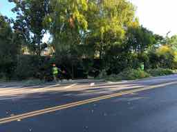
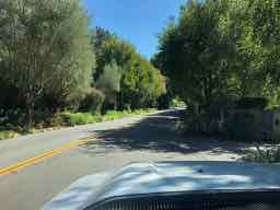
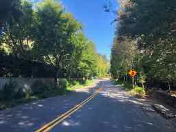
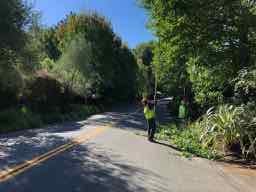
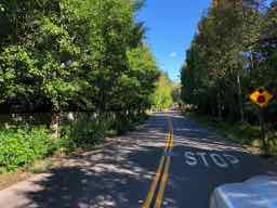
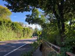
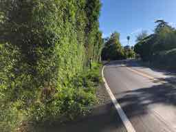
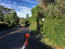
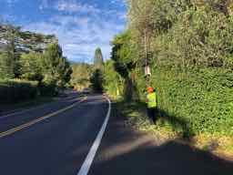
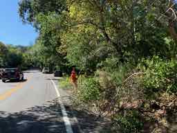
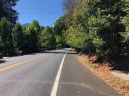
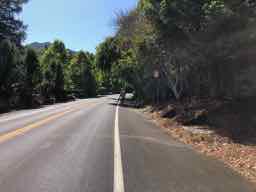
The following are general examples of the type and structure of of vegetation that will be removed to improve evacuation routes and emergency vehicle access. Hover over the image to see the proposed vegetation clearance.
Example Images
The following are general examples of the type and structure of of vegetation that will be removed to improve evacuation routes and emergency vehicle access.
Privacy Screening
Crews will be attempt to minimize the impact to privacy screening, however residents must be aware that the presence of certain combustible screen plants may constitute a fire hazard and violation of codes and ordinances.
Kentfield Fire Protection District encourages residents to choose fire-resistant privacy screen plants, and maintain them so that they do not intrude into the public right-of-way or impede emergency vehicle ingress and egress.
See www.firesafemarin.org/plants for information on fire-resistant privacy screens and hedges.
Work Calendar
We anticipate work to begin mid-September, 2019, and last for approximately 4-6 weeks.
Contractors
Work will be performed by private tree-services and contractors.
Map
![]() Download the project overview map in PDF format.
Download the project overview map in PDF format.
Kentfield Fire Protection District and FIRESafe MARIN, under the terms of the grant, may apply funding to reduce hazardous roadside vegetation on ANY roadway in the Kent Woodlands State Responsibility Areas (SRA) where necessary to improve evacuation safety for residents.
